
Great Falls Whitewater Guide
The definitive guide to running the Long and Short Bypass channels.
River Description
The Long Channel of Great Falls of the Catawba has been largely dewatered for a century. Negotiations between Duke Energy, American Whitewater, and many other parties starting in 2002 led to a settlement agreement and new dam license that calls for significant flow restoration. Base flows and recreation flows began in March of 2023.
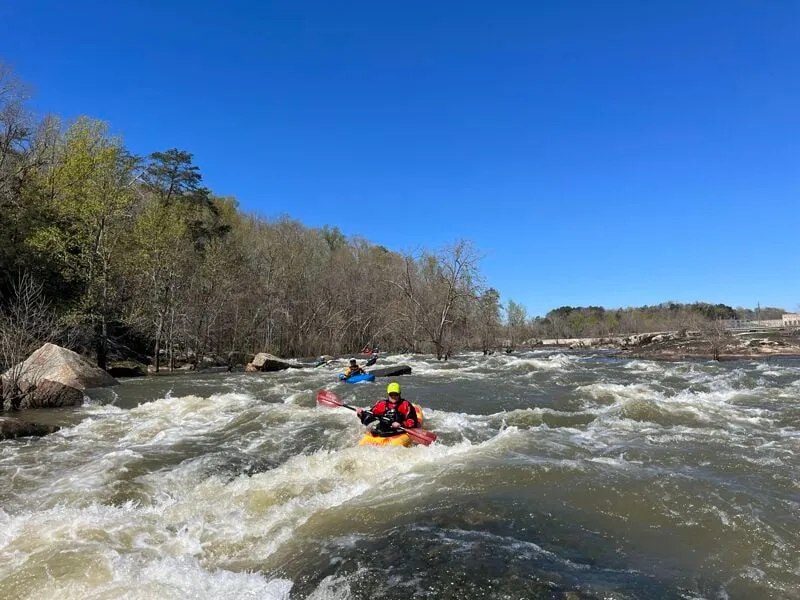
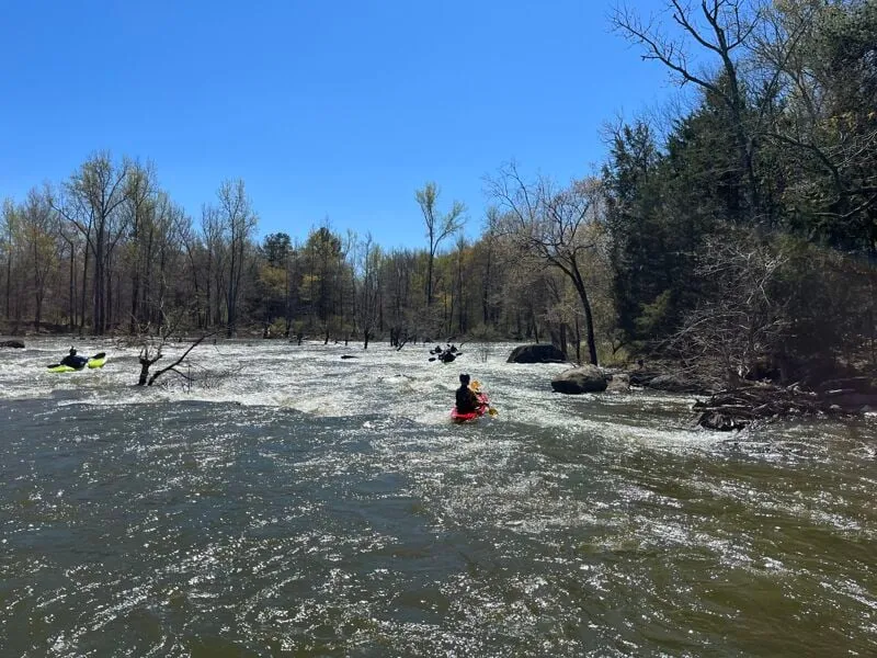
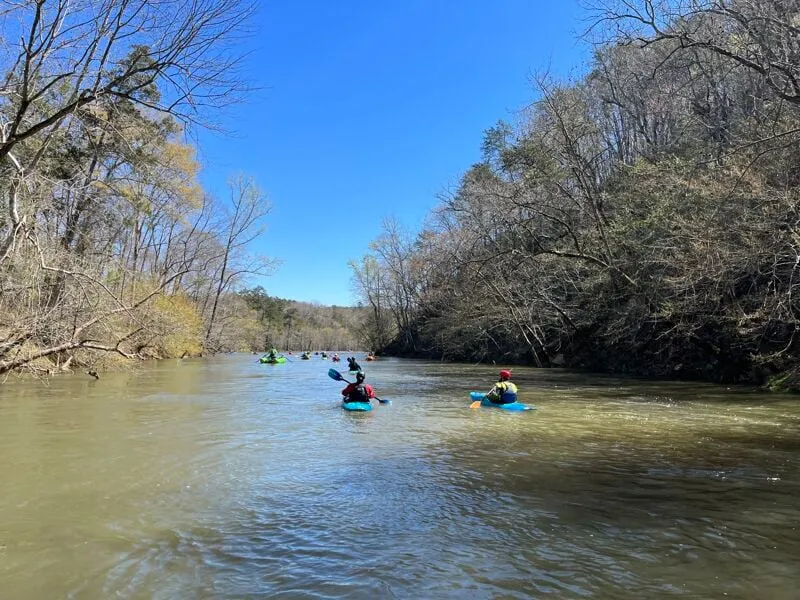
The Long Channel is 2 miles long, but so wide you'd have to run it several times to see it all. Expect to be paddling through a forest in some areas if you get off-route, because trees have grown in the long dewatered riverbed. Generally, after the first couple rapids head toward the island that forms river right, and you'll find a mellow flatwater channel that leads you around a tree-filled section and back into the open rapids. Note that standing and down trees are a serious entrapment hazard, so only experienced groups of paddlers should run this section. Expect long series of class II+ and III- rapids with lots of eddies and surf waves and holes. The whitewater is akin to Section 9 of the French Broad though in a much bigger more spread out river. When you hit the reservoir paddle across to Stumpy Pond River Access Area to take out.
Paddlers should launch at the very nice new Nitrolee Access Area just upstream of Highway 200, and enter the Long Channel through one of two man-made channels over the dam, which are entered near the island on the river right side of the Long (lefthand) Channel. Expect very different conditions in the man-made channel depending on flow.
Nitrolee Put In
A new put in has been built on Fishing Creek, just upstream of the main bridge. Park here and launch, paddling down the flatwater fishing creek and trending left to the left edge of Mountain Island.
Diversion Dam Paddling Channels
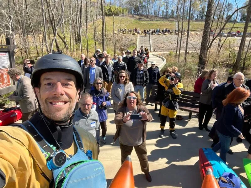
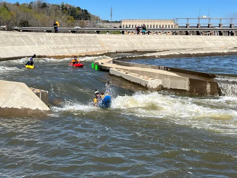
Duke Energy created this structure to allow water and paddlers to flow from the reservoir above into the river below. The idea was first pitched by AW's Kevin Colburn and Andrew Lazenby, and Duke hired Scott Shipley to design the project. The large channel will have water all the time, 850cfs February 15 through May 15 and 450cfs the rest of the year -- and much more during recreational releases -- and features several large waves. The smaller 'paperclip' channel on the right side will only have water during recreational releases, around 450cfs, and features 8 surfable drops ranging from waves to holes. Both channels are designed to release specific volumes of water into the river below. Paddlers will have access to stairs and a walkway to scout, run laps or portage the structures on far river-right, adjacent to the island in the pool at the start of the paperclip. Please scout first!
#1
This class III rapid features several excellent lines, a few standing trees in the current, and good surfing. Be mindful of trees, and that the boulders are undercut, but there is a lot of whitewater real estate in this section. The flow is still focused here before spreading out downstream.
#2
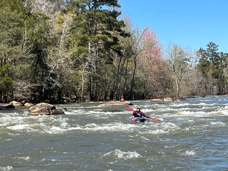
This is a wide open rapid with small surf waves and several routes. Trend right though and finish right against the right bank to enter the mellow channel around the forest.
Peace Valley
This is where you want to be. This canal-like channel is very pretty and entirely tree-free except for a spaced out fence of trees at the start. Use this channel to avoid the forest that spans the rest of the river here.
#3
This is a super fun rapid after the calm of Peace Valley with many routes. Choose your own adventure and have fun!
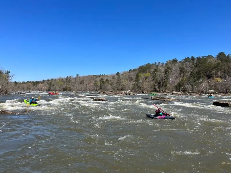
#4
A long series of fun moves spread out across the river. Find the fun, while it lasts!
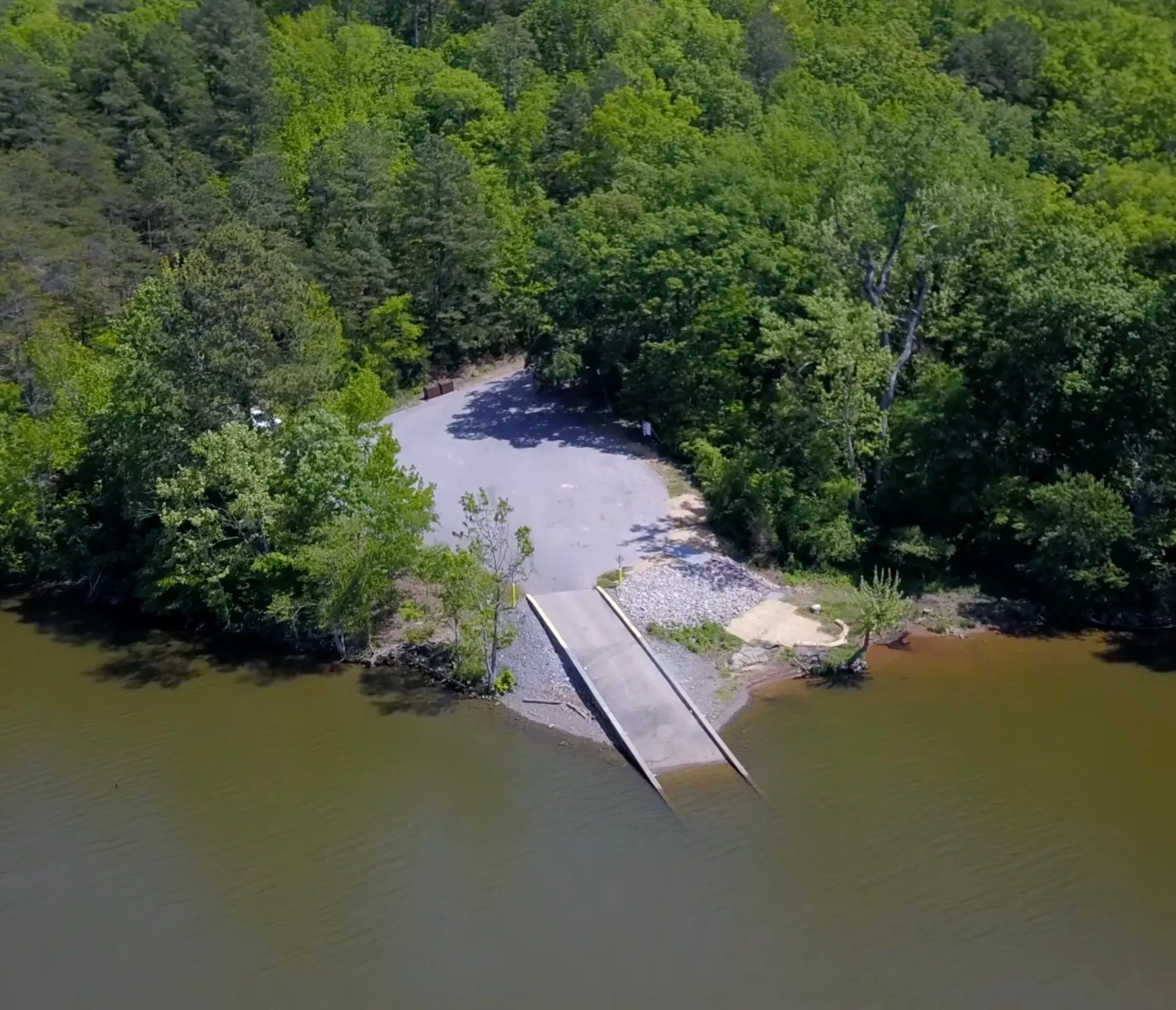
Stumpy Pond Take Out
Paddle across the reservoir to reach the take out.
Interactive Entry & Features Map
Find launch spots, parking, and specific rapids on our tourism map.