
Great Falls Whitewater Guide
The definitive guide to running the Long and Short Bypass channels.
River Description
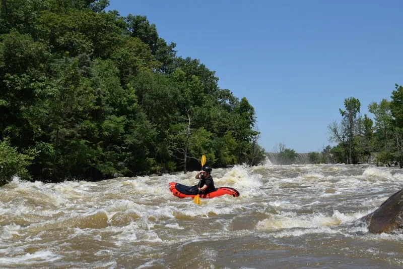
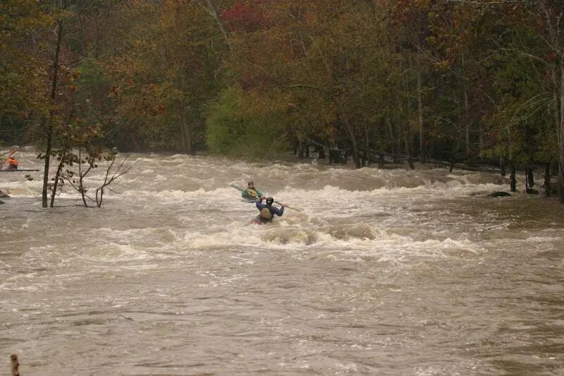
The Short Channel of Great Falls of the Catawba offers significantly bigger and more challenging rapids than the Long Channel. Several rapids include relatively big waves and holes. The first rapid is just below the put in and offers a fairly straightforward big wavetrain down the center-right that can be made easier by finishing left at the very bottom. There are some holes in the lead-in that are easily avoided. After this is a break and then 2 sets of rapids with multiple channels and routes. The biggest and clearest line is generally down the middle/right channels. Everything can be boat scouted.
Starting in July of 2023 there were new releases and access following over a century of being dewatered. There is a new 100 cfs base flow restored to the river, plus 2,860 cfs recreational releases from 10am to 3pm, One Saturday per month in March and April, plus 2 weekends (Saturday and Sunday) per month from May 1 - October 31. American Whitewater worked closely with other groups to negotiate these releases.
Paddlers will initially begin their Short Channel trips at the same Canal Street Access Site, or for a longer paddle could begin at the Nitrolee Access Area that offers access to the Long Channel. Accessing the run requires a portage around the diversion dam on river left. Look for the very obvious portage landing on Mountain Island (the left bank) and take the trail and stairs to the base of the dam. After your run, paddle across the reservoir to the Stumpy Pond Access Area or hike back up the short channel on the river left trail.
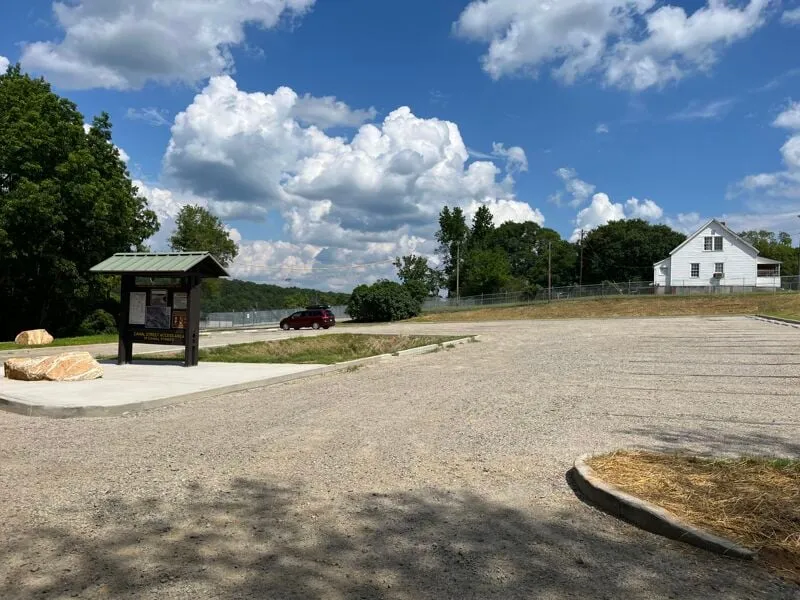
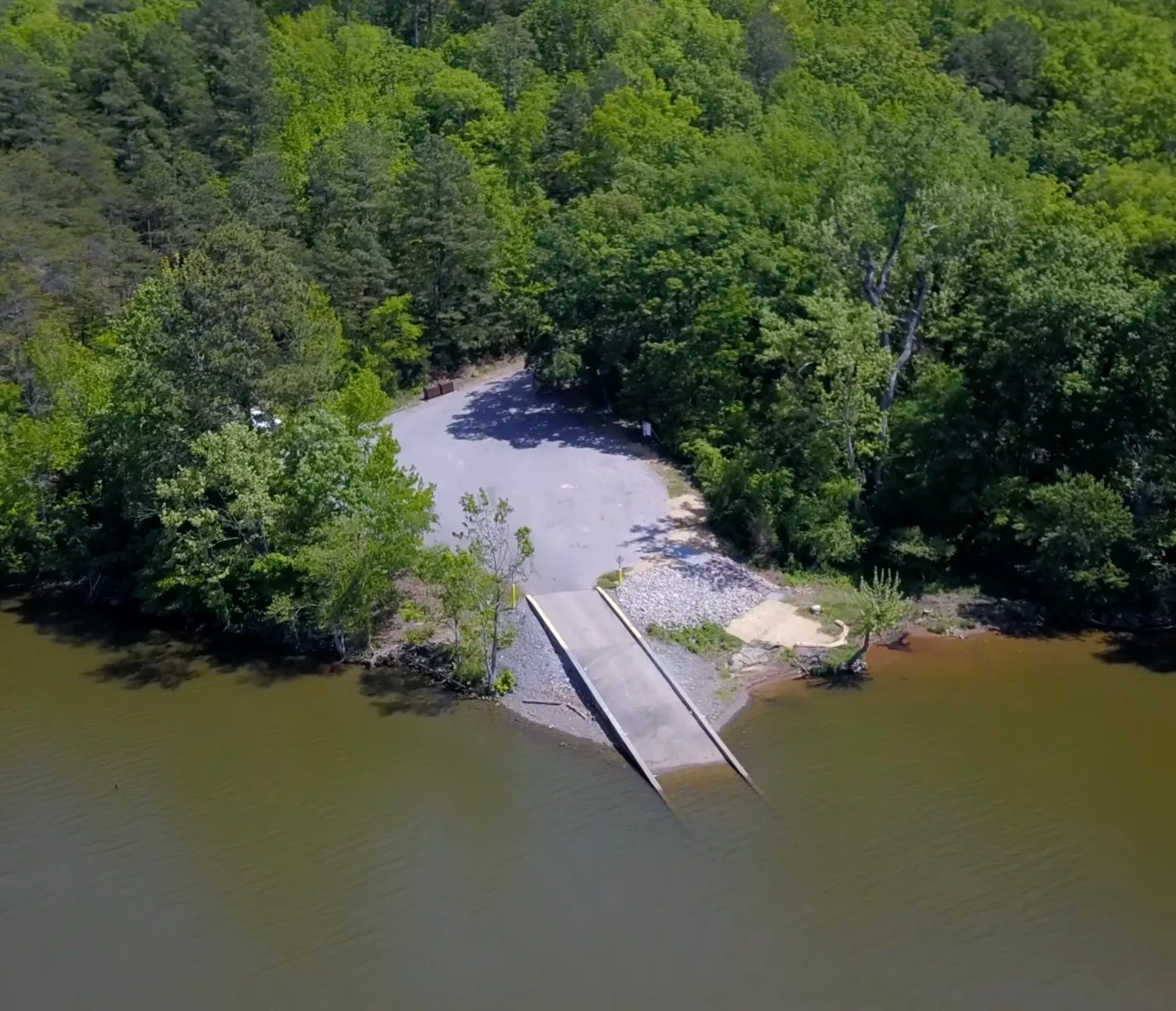
Canal Street Put In
Duke Energy built a nice put in here for paddlers! Park in the lot and walk down the new trail located at the upstream end of the lot. Paddle straight across the reservoir to the obvious landing, walk around the dam on the portage trail, and launch below the dam.
Turtleback Rapid
Starting at the dam, the main flow goes left around a rocky island with a few trees. Flow is then split by a logjam. Line is to the right of the logjam. Immediately past the logjam there is Turtleback. There are (at least) 2 options. Go just left of the exposed rock on the right for a straight drop (this might turn into a nasty pour-over at release levels), or head straight down the center, avoiding the Turtle Back shaped rock that is just under the surface about 8' from the river left bank.
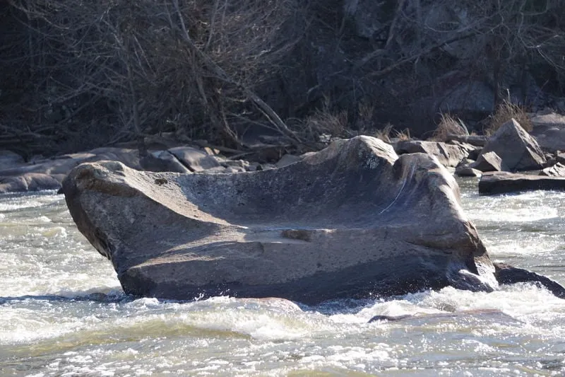
Broken Bowl Rock
The Broken Bowl Rock. Head to the right of this to follow the main flow through the rapid below.
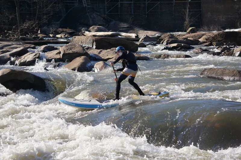
Great Waves Rapid
Once through Turtleback, there is about 50 yards before you enter the meat of the run. You'll see an 8' wide rock that looks like a broken bowl in the center of the river. This bowl rock marks the start of the rapid. Line is to the right of the toilet bowl, and then stay right of the pyramid rock. Pick your way down. Lots of surprisingly pushy water, back-to-back small drops, waves and surprise holes. Hug the right bank for the easiest route, or down center-right for a bit more action. Left bank has a submerged tree. Rapid ends in wavetrain that looks like it could liven up at release-level flows. Reminiscent of Radiotower on Lower Noli, just without the getting-stuck-on-every-rock part. Lots of elevation drop over the rapid, but it's a consistnet grade with no major, nameable drops or holes. Looks to be potential for playspots and surfing at release flows.
Barracks Ledge
The mid-run-pool ends with a small rocky island with a few trees and a river-wide line of boulders. It's a bit of a choose-your-own adventure, but everything to the right of this island is filled with dead wood, so not the adventure I would recommend. We took the left channel, staying 10 yards or so off of the left bank because of the dead wood here also. Around the side of the island, (maybe 75 yards in) you'll see a horizon line. Some lines are cleaner than others, but the best option we saw was to simply run the ledge straight down the middle. It's about a 3' drop, comparable to a mini version of Murphy's ledge (Noli Gorge). Rest of the way down (200 yards or so) to the lake is just a Class II+ game of dodge-the-barely-submerged rock. Quick history lesson - around 1800 Washington + Jefferson decided to build an Armory in this area to serve the southern states, at the same time they approved construction of the Harpers Ferry and West Point Armory. Eli Whitney (yep, the Cotto...
Mountain Island Take Out
Immediately after the rapids end, you can pull out on the river left bank at Mountain Island. There is no boat ramp here, but a portage trail leads back upstream along the west side of the island — perfect for quick re-entry at the top of the Short Channel if you want to run more laps, or for hiking back to your car at the Canal Street parking area.
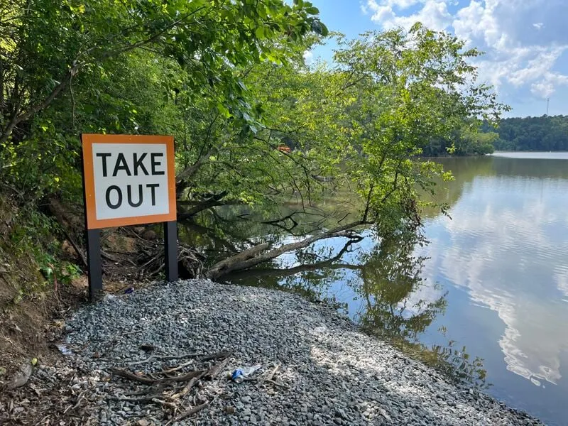
Stumpy Pond Take Out
The official take out with a boat ramp and dedicated parking area. After the rapids end, paddle across the calmer reservoir for approximately 20–30 minutes to reach the Stumpy Pond Access Area on the left side. This is the primary exit point if you're done for the day and need to load up your boat.
Interactive Entry & Features Map
Find launch spots, parking, and specific rapids on our tourism map.